Ali Pasha Castle Tepelena

The Castle of Tepelena was declared a Cultural Monument of the first category in 1963 and is located north of the city of Tepelena, Tepelene Municipality. According to historical sources, the castle was designed by Ali Pasha Tepelena himself, who oversaw the first stages of construction of this heroic symbol of the region. The existing castle was rebuilt by him in 1819 with an area of 5.5 ha, with three entrances and three towers. Until 1820, it was used as the second residence of Ali Pasha Tepelena. The walls of the castle are attached to the natural shape of the land and do not consist of a regular geometric shape. Three polygonal towers are placed at the main bends of the walls, to better control them. The castle has three gates, one of which (eastern) bears the inscription “Gate of the Vizier”

Lekli Castle Tepelena

Lekli Castle is another cultural monument of the first category protected by the state. It belongs to the IV century BC. Lekli Castle stands on the hill called Shen Mëhill in the western part of Golik mountain. The rocky hill where the castle is located was chosen for its strategic position to control all the paths and roads connecting Illyria with Epirus, which in antiquity were known as the Straits of Antigone. These are mentioned in the wars of the end of the III – V centuries BC. of s. From the Lekli Castle it was easy to control the northern entrance to the Drinos Valley of all the war troops. Lekli Castle has attracted the attention of various archaeologists such as Hamondi and Ugolini who visited it in the 20th century. Albanian archaeologists also started excavations near the Lekli castle in 1948, and this continued until they discovered the city of Antigone by Dhimosten Budina on the hill of Jerme, Saraqinisht. Antigonea was a complete and powerful archaeological site and from that moment the Lekli Castle was left behind and no more excavation work was done. However, there is no clear picture of the shape of Lekli Castle

Qyteza Castle Tepelena

The castle of the town is located on the hill near the village of Dukaj, 300m above sea level. The castle has the shape of a regular quadrangle that covers an area of 0.5 ha. This small town belongs to the IV-III period, BC. For the most part it is very well protected by nature and is also quite well fortified by strong walls in the open natural parts. The castle was equipped with three towers, the walls of which rested on the carved rock with the aim of avoiding landslides

Matohasanaj Castle Tepelena

The ancient castle of Matohasanai is located on the top of a rocky ridge, which rises in the center of the Sinanaj valley, between the bed of the river Vjosa and the mountain of Griba. The castle belongs to the c. 5 BC and there are traces of the continuation of life in almost every subsequent period. The walls of the castle surround an area of about 3 ha, an area consisting of rows of terraces suitable for living. The surrounding walls belong to three different periods of construction, the first two periods represent the Antiquity period in this city, while the third period of construction represents Late Antiquity
Nivica Castle Tepelenë
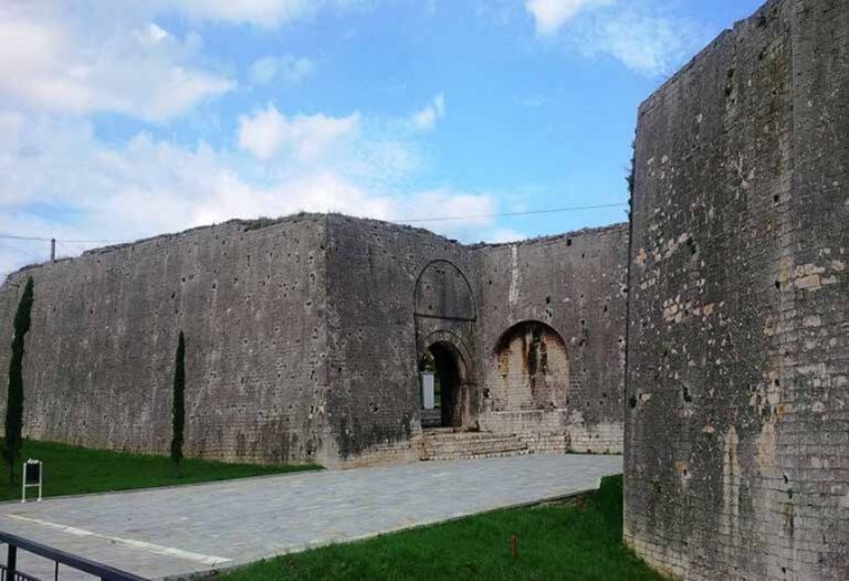
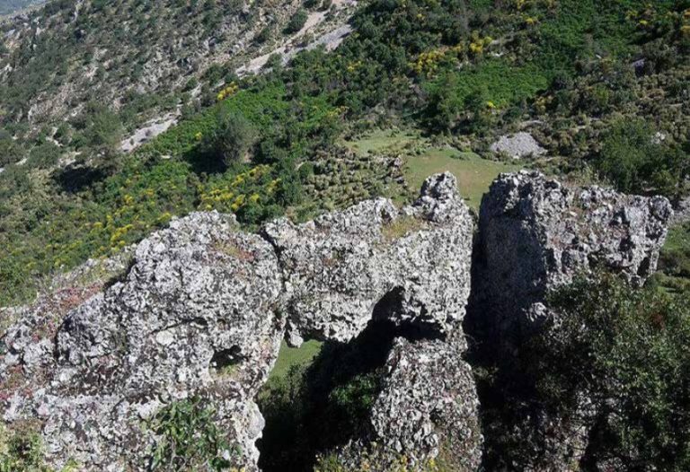
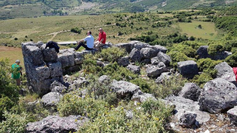
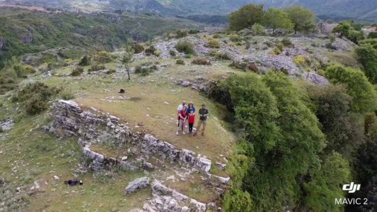
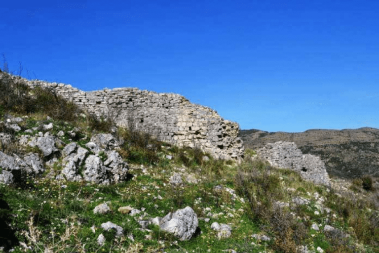
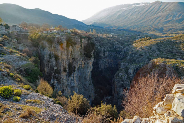
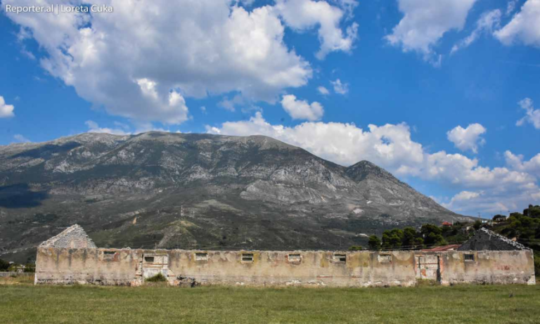
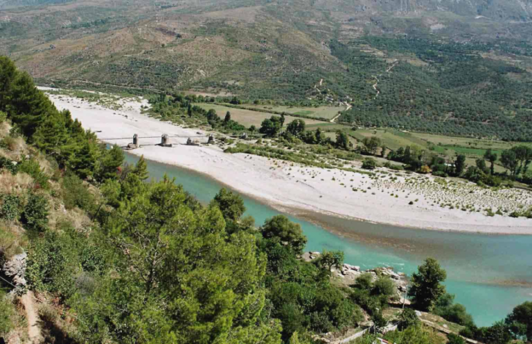
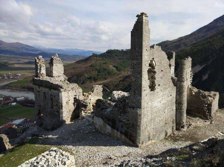
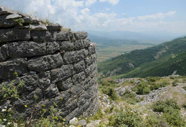
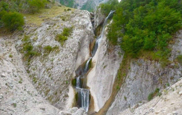
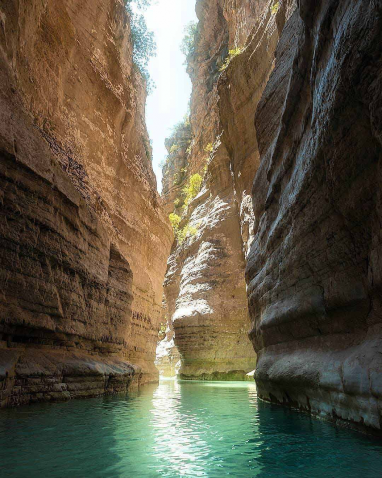
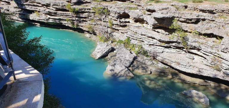
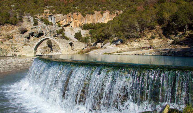
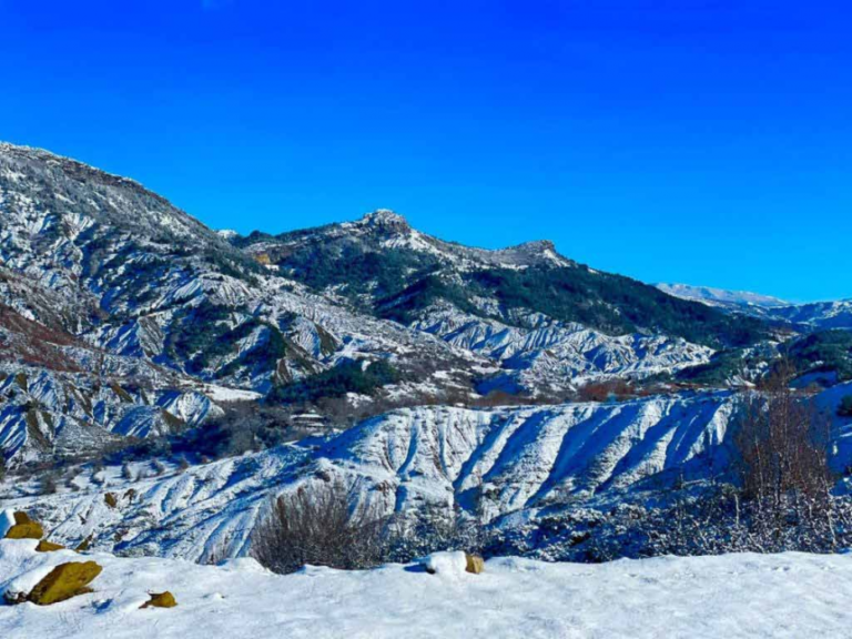
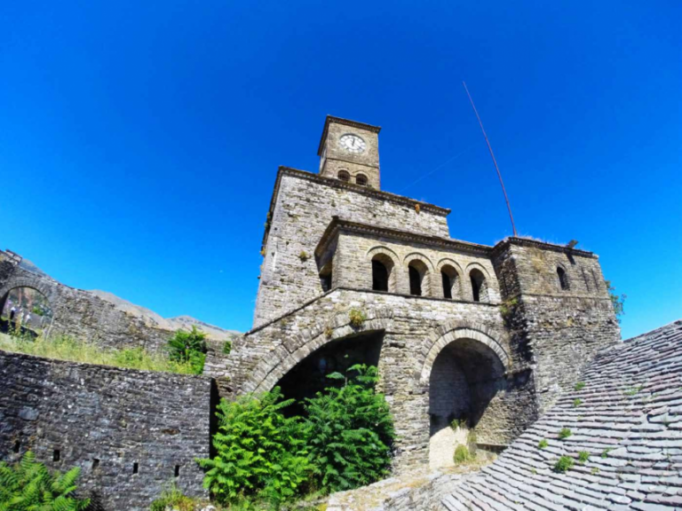
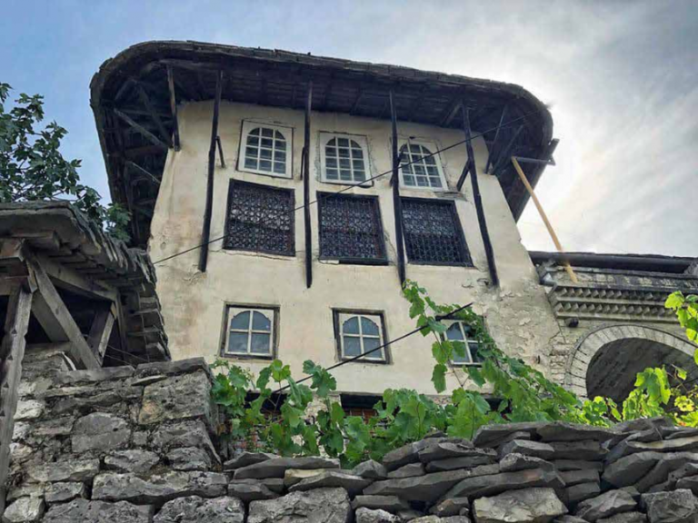
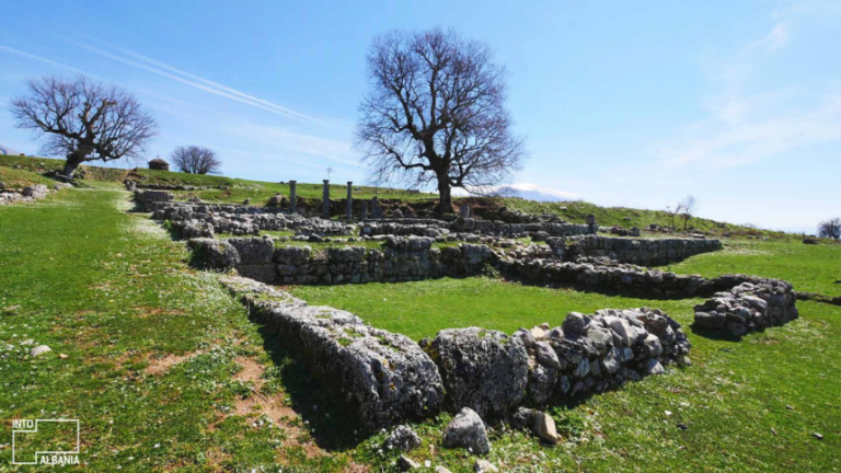
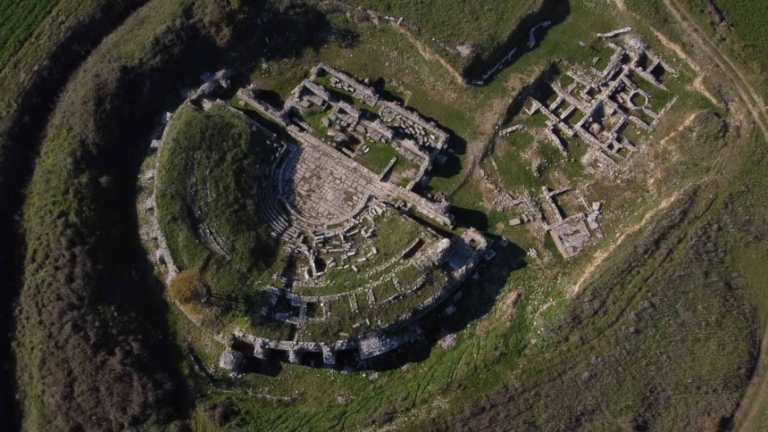
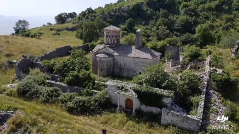
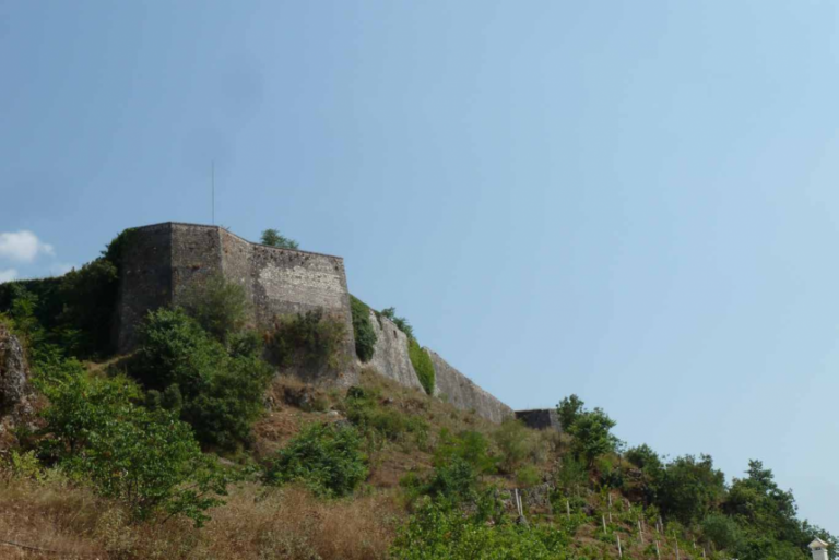
The ruins of the Nivica castle are located on top of a steep rock, surrounded by an abyss, with a depth of 200-400 meters. There is a natural defense on three sides, while only on the West it is protected by a stone wall with lime mortar over a meter wide. Until recently, an inner gate with a vault was preserved, built with hewn stones 0.5-1 meters long, extracted from the rocks of the area. On the eastern side, an almost steep track can be seen that descends towards the river through a gateway cut in the rock. These stairways connect the fort to the river as well as to two mills that operated via a water line that flowed from a crack in the rock. Apparently, this was also the supply route for the castle in case of sieges. The castle is built on an inaccessible rock, at a strategic crossroads. The road of Vermiku, Salaria, Kuçi and Bênça pass here. According to the French Pouqueville, the Illyrian tribe of the Amants lived here, who were the first to build the castle in the 4th century BC. After that, it is thought that Nivica has become the second inhabited center for the tribe of Amants. Archaeological data show that the city reached its peak of prosperity in the III-I centuries BC, while the Ottoman chroniclers of the period of the Albanian-Turkish wars speak of a city with 500-600 houses. The castle was rebuilt in the period of Byzantine rule by order of Emperor Justinian, who attached special importance to the military fortifications in Arbëri. In the period of the Slavic invasions and then during the Ottoman occupation, the fortress of Nivica was an important theater of battles, being occupied sometimes by locals and sometimes by foreigners.
Zharra Castle Tepelena
This fort rises on top of the rocky hill with the same name and 310 m high. The hill is located west of the town of Tepelena on the left side of the Vjosa valley and extending from south to north takes the shape of a nose. From this position you can check the roads that pass on this side of the Vjosa valley. The first to visit the Zharra castle was Pouqueville, according to whom this castle is the work of the Latins, then it was visited and mentioned by H. Holland. Among the Albanian archaeologists, H. Ceka was the first to visit it, described the state of the ruins and spoke about the time of its construction. Then, in 1963, an informative expedition was made, with the aim of knowing the state of the monument. The first excavations in this castle were done in 1970. These excavations were directed by D. Komata. This castle belongs to the period of Late Antiquity (4th-6th centuries AD) and it is thought that it could be one of Justinian I’s military fortifications. The wall follows the relief forms of the fortress on which it is erected, taking the form of an elongated ellipse with a perimeter of 410 m and surrounding an area of ​​0.8 ha. It is followed along its entire length, although in some parts it is damaged and completely collapsed. Its greatest height is 2.8–2.9 m. The thickness of the wall varies from 1.6 m. in 1.8 m. For its construction, medium limestones were used, which are worked or unworked and of different shapes and sizes.
Benca water supply Tepelena
This fort rises on top of the rocky hill with the same name and 310 m high. The hill is located west of the town of Tepelena on the left side of the Vjosa valley and extending from south to north takes the shape of a nose. From this position you can check the roads that pass on this side of the Vjosa valley. The first to visit the Zharra castle was Pouqueville, according to whom this castle is the work of the Latins, then it was visited and mentioned by H. Holland. Among the Albanian archaeologists, H. Ceka was the first to visit it, described the state of the ruins and spoke about the time of its construction. Then, in 1963, an informative expedition was made, with the aim of knowing the state of the monument. The first excavations in this castle were done in 1970. These excavations were directed by D. Komata. This castle belongs to the period of Late Antiquity (4th-6th centuries AD) and it is thought that it could be one of Justinian I’s military fortifications. The wall follows the relief forms of the fortress on which it is erected, taking the form of an elongated ellipse with a perimeter of 410 m and surrounding an area of ​​0.8 ha. It is followed along its entire length, although in some parts it is damaged and completely collapsed. Its greatest height is 2.8–2.9 m. The thickness of the wall varies from 1.6 m. in 1.8 m. For its construction, medium limestones were used, which are worked or unworked and of different shapes and sizes.
The medieval bridge of Beçishti – Ali Pasha Tepelena Tepelena
This ancient-medieval bridge is located below the fortress of Tepelena over the river Vjosa. It is otherwise known as the Beçishti Bridge. This bridge has traces of the Roman period, the first half of the 1st century BC. During medieval times it was rebuilt on the foundations of the Roman bridge. It was then restored by Ali Pasha Tepelena, in the 17th century AD. The bridge is 260 m long. The Beçishti Bridge, built at the time of Ali Pasha, connects Tepelena with 7 villages. It is thought that the village of Beçisht is also the place where Ali Pasha was born. Even today, the ruins of his house can be found in the village
The cold water Tepelena
Cold Water is a tourist area 8 km south of the city of Tepelena. It got the name “Cold Water” because the area is dominated by natural rock springs where the water always flows cold and clean. The source has existed for more than 250 years and was excavated in the rocks of the mountains of Tepelena, a quiet town in the south of Albania and the homeland of Ali Pasha, a historical figure who lived between the 1700s and 1800s, who is also known for discovering source. Thanks to the underground wealth of this area, dozens of crystalline springs come to life in Ujin e Tohte, which “feed” the flow of the Vjosë river. The slope where the spring comes out is covered with natural vegetation of oak and bushes. The natural park of Cold Water consists of a rather rich vegetation of various types. In addition to the bushes, the maple wood or the willow prevails in it. In the vicinity of the valley, the maple trees are quite mature. Meanwhile, along the surface of the natural park, you can also find various creatures and animals typical for this area. Cold water in Tepelena has scientific (hydrological, geomorphological), aesthetic and touristic values

Peshtura Waterfall Tepelena

The waterfall of Peshtura is located in the Progonat of Tepelena and to get there you have to pass through the mountains of Tepelena. The area consists of limestone rocks which have been traversed by rapid and playful streams for centuries. Numerous karst formations, deep pits, numerous caves and waterfalls is the landscape that offers the way to Peshtura Waterfall

Nivica Canyons Tepelena

The canyons of Nivicë are located near the village of Nivicë in the district of Tepelene. They have a length of up to several km, an average width of about 15 m, while the depth reaches up to several tens of meters. They were formed by the erosion of the Nivice river, part of the Bence river, in limestone rocks. The slopes of the canyon are vertical, have boulders and karst caves that are very difficult to explore. Passing along the bottom of the canyon is difficult, as there are rapids up to several meters high. Their magnificent appearance, the greenery on both sides of them, make them attractive. They have scientific (geomorphological, geological), didactic and touristic value. They are visited along the Tepelene – Progonat – Nivice highway
Tepelena Museum Tepelena
This museum is located in the center of the city of Tepelena. In this museum there are objects belonging to different time periods, including archaeological, historical, ethnographic objects and documents. These objects are displayed in the Museum, and represent the way of living in the Tepelena region during different periods, starting from the Bronze Age, up to the present day. The most important objects are displayed in the archaeological pavilions, and the most important period when the finds were made belongs to the time of Ali Pasha Tepelena, as well as the part of the war for independence, the battles of Vlora and the war against the Germans for the liberation of the country
Tepelena Camp Tepelena

The Tepelena Internment Camp or Tepelena Camp was an internment structure similar to the Soviet collective farms near the fortress of the city of the same name, in the People’s Republic of Albania, where the family members of convicts, fugitives and military deserters were kept. A large number of children were also kept and due to the conditions there was a high infant mortality. The camp was identified by two numbers, 4 and 6, and was active from April 1949 to March 1954. The Tepelena camp gained notoriety in the international arena, even appearing in the US government’s report to the UN in February 1955. The documentation of inherited, especially the decision-maker regarding the names of the people who were in these camps, due to the poor quality of the administration of the time is very little

Vjosa river Tepelena/Përmet
The Vjosa River is the largest river in Southern Albania and one of the largest rivers in Albania, especially in terms of numerous water flows. The length of this river is 272 km, the surface of the watershed is 6706 km2, of which 4365 km2 are within our territory, while the rest is in Greek territory. The main branches of Vjosa are: Sarandoporo, Drinosi and Shushica. Many karst springs end in Vjosa or in its branches, such as the gorges of Këlcyra, Libohova, Viroi, Gjirokastra, Cold Water of Tepelena, Pocem, etc. Vjosa originates from the mountains of Pindis (Greece) where it flows through a deep valley which widens after entering our territory
Drino Valley Tepelena/Gjirokastra
The beautiful valley of Drinos is 50 km long and stretches from Koshovica on the border with Greece, to the bridge of Subashi in Tepelena. The valley lies between the Lunxheri-Bureto ridge and Malit Giëra in the east, and the Kurvelesi Plateau in the west. It has been a trade route for centuries and includes the city of Gjirokastra

Benca River Tepelena

Bënçe River is a stream and is located in Gjirokastër/Tepelene, Albania. The estimated height of the terrain above sea level is 159 meters
Saint Mary Leu Church Përmet

It is of the basilica type, built at the end of the 18th century, measuring 23 m in length and 10.5 m in width. The nave is divided into 3 naves, where the lateral ones are covered with spherical vaults, while the central nave has a cylindrical vault. The dome rises above the narrow, high drum and the 12 windows are located in the middle space. A two-story narthex and altar area complete the structure. A small chapel built later is attached to the south side. The church is built with local stones and covered with stone rasa. The church, rich in wall paintings and iconostasis, has an inscription painted over the entrance gate which testifies to the skills of those who worked. The wall paintings are from 1812, while the carved iconostasis bears the date 1817. The frescoes and the iconostasis carved in walnut wood are of special artistic value. Pictures and compositions in wood taken from the Bible and from nature have a high style and craftsmanship.

Palace Ruins of Ali Bey of Kelcyra Përmet

It rises on the rocky side of Mount Trebeshina, at the entrance of Gryka e Këlcyra. The founder of the Këlcyra family is thought to be Teodori from the Muzakaj family. Saraje was built in the middle of the 19th century and is one of the largest constructions in Albania. It is an incredibly magnificent building with eight large towers of four stories each and a basement. The building alone has an area of 3000 m². Burnt by the Greeks in April 1914, for more than a century these ruins have stood majestically on the slope of Mount Trebeshina

Tekke of Frasher Përmet
It is a very famous cult and historical monument in Albania. It consists of two separate buildings, which are connected to each other through a wall. The upper building has the shape of the letter “L” and consists of three areas: “Cafe Oxhaku”, “Ashefi”, “Furra e Bukës” while the lower building is partly two-storey and there is “Mejdani”, the sacred place where the ceremonies took place religious and Bektashi school (opened by Baba Nasibiu in 1781-1785) where Turkish, Persian and possibly Arabic were taught as foreign languages. Teqeja was built in 1781 by Sulejman Bey of Frashëri
Ali Postivan Tekke Përmet
It rises on a beautiful hill above the village of Alipostivan, in a dominant point from where it looks like in the palm of the hand the valley of Vjosa. Teqeja was built for the first time by Baba Ali in 1857, in whose honor it is named. Teqeja, 2 Tyrbet and other premises are connected to each other by a concrete road and stairs, and terraces planted with various fruit trees have been erected around them. Its buildings are white, contoured with green, and their domes shine like the sun. The hotel is built on the left side of the main gate, which serves to accommodate believers and various visitors. The wonderful ensemble of Teqe, in addition to having spiritual values for the Bektashi believers, is also seen as an object with rare cultural values for local and foreign visitors.
The Saint Mary’s Church Kosina Përmet
The church rises on a hill on the right side of the national road, about 5 km from Përmet traveling towards Këlcyra. It is of the inscribed cross type with a drum dome and consists of a narthex that is rectangular and covered with a cylindrical vault with a north-south formation. The narthex from where you enter the nave consists of the central environment with a dome, the four arms of the cross and the corner environments. The entrance gate is covered with an arch while the cylindrical drum is built with bricks as well as the walls. In external views, the decorative load is very interesting: crosses, arches, sawtooth frames, friezes, herringbones. From the architectural features and decorative treatment, the church dates back to the 12th-13th century
Saint Mary’s Church, Bênja Village Përmet
It is a rectangular building with stone walls while the roof is covered with thin stone tiles. The iconostasis was made in 1904 by the master Sionidhis Qioni. The church, divided into two rooms, reflects the characteristic division between men and women in terms of religious services. In the men’s hall there is a dome in which the figure of Jesus Christ is painted in bright colors. At the head of the great hall is the ajodhima (the place where the priest conducts religious services and the communion and anaphora are given) while on the right wing is placed the icon (konizma) of St. Mary of Bênja, covered with silver by Pandeli Saqellari. There, among other things, is the cauldron of atonement and the place where the spot is located. The women’s hall is smaller, but with two floors, the first is paved with stone slabs, while the second floor and stairs are made of wooden planks. This church is surrounded by cypress trees and overlooks the valley
Saint Friday’s Church in Permet Përmet
The Church of St. Friday rises by the stream from the southern side of the city. It is of the basilica type with considerable dimensions: 22 m long, 16 m wide and 8 m high. The church consists of 3 naves and is built with a pumice stone system connected with lime mortar and covered with a gabled roof with stone slats. Its interior decorations consist of wall paintings and wood carvings. The inscription engraved on a stone slab refers to the construction of the church in 1776 by the master craftsman Ilia Kristo, while the mural painting, with scenes from the Holy Scriptures, was made in 1808 by the painter Terpo Zografi, the son of Kostandin Zografi, a painter of frescoes and icons from Mokra e Korça. . The iconostasis and wood carvings were artistically worked under the direction of Dhimitri, the Albanian Master from Konica.
Church of Saint Kolli Përmet
The Church of Saint Kolli is located in the historical part of the city of Permet. It is of the basilica style and according to the Codex of the Metropolis of Korça, it was built in 1757. On the western side of its shrine, there are three guesthouses for the reception and accommodation of the faithful. Adjacent to Saint Kolli is the church of Saint Triadha, which was built in 2006. The church of Saint Kolli is surrounded by a courtyard with 7 cypress trees and where there is also a bell tower.
The Illyrian Castle of Këlcyra Përmet
It rises on the rocky side of Mount Trebeshina, at the entrance of the Këlcyra gorge. The castle is identified with the city of Eriboia of the Parauei, the Illyrian tribe that lived in the territory of Përmet. Researchers have raised a second hypothesis that we are not dealing with a city but with an Illyrian fortress. In this castle, we distinguish 4 construction phases: the first in the c. IV-III BC, the second in the III-V century, the third is related to the medieval reconstructions in the century. VI-XVIII and the fourth at the beginning of the XIX century
Historic Area Përmet
In 2017, the Albanian government rated the center of Permet as a protected area, mainly to protect some religious objects. The protected area includes the neighborhoods of Shenkoll, Varosh and Teke. Within this protected area are two religious buildings: Saint Friday Church built in 1776 and Saint Koll Church built in the 19th century. The protected area also includes Bolenga Hill and the castle, as well as old two-story houses and villas built hundreds of years ago.
Permeti Rock Përmet
Guri i Përmet is a rock formation located in the city. It is 42 meters high and the surface of its top is 650 square meters. On its top there are also archaeological ruins, which belong to the 4th century. Historians say that the old fortification was used as a strategic signal point for a military garrison, and today there are still ruins of that fort. The stone also has a history which is written on the entrance sign before you climb the stairs to its top. This story has been told from generation to generation. It is about a ruler in the Middle Ages named Premt, who, in order not to fall into the hands of the fort’s conquerors, decided to jump from the stone and met his death. He is considered a hero and it is said that the name of Përmet is named after him. Today the stone is a symbol of the city, a tourist attraction from which you can see the whole city
Benja Village Përmet
Bênja is a village in the Dishnica municipality in the Përmet district of Albania
Sopoti Waterfall Përmet

This beautiful waterfall is located south of Përmet, above the village of Stërbec. It lies at an altitude of 600 m, below the top of Mount Nemërckë. Network water from a large karst spring, flowing in glacial fluvial deposits. The waterfall has a height of 20 m and the sound of falling water can be heard from a long distance. The falling water creates a very beautiful, mesmerizing scene. This waterfall is one of the most visited in the area of ​​Përmet. It can be reached via a path that offers a wonderful landscape of the southern face of the German Mountain and its glacier. This glacier is in the form of a large armchair, 2 km long and 600 meters wide. To access this trail you need to park in the village of Stëmbec, and then walk to the meadow below the center of the village. From there follow the unpaved road towards the hill. Once you reach the center of the village, take the narrow road next to the houses. Then after a few meters you will reach directly at the top of the path. Then the path is clear and continues gently towards the hill without breaking away from the beautiful views of Nemerčka mountain. From here you can see the waterfall and then it invites you towards you, so the path becomes much clearer. The trail has some exposed parts where you need to be careful, but it’s generally safe.

Lengarica Canyon Përmet
The Lengarica River has a length of 36.6 km and flows in the southern part of Gramoz mountain, forming a magnificent canyon consisting of limestone rocks, which starts from Ura e Dashi to Ura e Katiu with a length of about 3,700m. Along the canyon, in addition to the thermal waters of Bênja, there are also caves, among which we mention the “Cave of Pigeons” and the “Cave of Katiu” used as settlements in ancient times.
Gorge of Kelcyra Përmet
This magnificent gorge which stretches between Këlcyra and Dragot with a length of 13 km forms a canyon whose depth reaches up to 1,000 meters. On the right slope of the gorge there are the caves of Mezhgoran and Dragot, while along the river you can admire many underground springs, among which we single out the Black Water of Këlcyra which comes to the surface on the edge of the bed of the Vjosa river, creating a variety of colors. Of special beauty are the karst springs of the area called “Rrepet e Këlcyra” which come to the surface at a height of about 50 m above the bed of the Vjosa river, creating wonderful waterfalls.
Benje Thermal Waters Përmet
This magnificent gorge which stretches between Këlcyra and Dragot with a length of 13 km forms a canyon whose depth reaches up to 1,000 meters. On the right slope of the gorge there are the caves of Mezhgoran and Dragot, while along the river you can admire many underground springs, among which we single out the Black Water of Këlcyra which comes to the surface on the edge of the bed of the Vjosa river, creating a variety of colors. Of special beauty are the karst springs of the area called “Rrepet e Këlcyra” which come to the surface at a height of about 50 m above the bed of the Vjosa river, creating wonderful waterfalls.
“Bredhi i Hotova Dangelli” National Park Përmet
It can without a doubt be considered the natural lung of southern Albania. This park has an extension of 1400 hectares and a magnificent massif composed mainly of Macedonian fir (Abies borissi-regis), with an average height of 25-30 meters. The park represents one of the tourist pearls of Albania and offers pleasant surprises in all seasons of the year
Gjirokastra Castle Gjirokastra
Gjirokastra Castle is one of the largest in the Balkans. Like a huge stone ship, it spans a span of 335 meters. It is located on the hill from where the whole city can be seen, as if to witness the history of the entire region over the centuries. The date of construction of this fortification is still unclear. If the walls of Gjirokastra Castle could talk, they would tell many stories about the different civilizations and legends that have lived here for centuries. Archaeological discoveries in the area of ​​the castle show that this place has been inhabited since the 4th-5th century. According to historians, the first walls of this fortification may have been built after the fall of Hadrianopolis. But the first walls of the town were built in the 12th-13th century. The castle was originally built as a typical feudal property of the time, by wealthy families who wanted to be safe and protected from various wars. It later turned into a residential center for many other families
Gjirokastra Bazaar Gjirokastra
The Bazaar Pass in Gjirokastre is the center of this old town. The history of Pazar dates back to the 17th century. In fact, not much remains from that period. Sources say that a devastating fire affected the old bazaar in the 3rd quarter of the 19th century. After that the bazaar was completely rebuilt. This is why the bazaar buildings have the same architecture, some are 2-3 stories, but identical in structure and all in one line. The first floor is where the artisans worked throughout the day, while the second floor was used for different purposes by each of the artisans. Some shops have a back door, which was used only by the owner. A narrow sidewalk for people was built in the same period, which makes this bazaar unique from all its contemporaries.
The Cold War Museum Gjirokastra
The Cold War Museum (Cold War Tunnel) is an underground bunker, which served as an emergency shelter during the years of the communist regime in Albania (1944-1990). The bunker and other small ones throughout the country reflect dictator Enver Hoxha’s paranoia over any possible attack. He feared a foreign invasion, especially after the split with the Soviet Union in the early 60s. Built in secret in the early 70s, the bunker is 800m long and has 59 rooms. The bunker is left in its original state, which although without much information is original and scary. This bunker is designed to perform many different functions in the event of a nuclear attack. There are rooms for government ministries, local government, interrogation rooms, party elite as well as places to sleep, for power generators and water storage.
Weapons Museum and Prison Gjirokastra

The Weapons Museum was opened in 1971 as the National Armaments Museum where all the weapons and their types used during World War I and II were brought. The weapons that are in the museum are from the war for independence in 1912 to the war for the liberation of Albania. Most of the weapons museum is dedicated to the partisan war against the Italian and German invaders in the years 1939-1944. Part of these weapons is an American fighter plane that has remained there since the cold war. The entrance to the Prison is located in the first gallery of the weapons museum. Completed in 1932, the prison was commissioned by King Zog, and built by the Italians. It looks different from the rest of the castle. The stones for its construction were taken from Ali Pasha’s aqueduct. During World War II, the prison was used by the Italian and German occupation forces. Residents say that the communist regime used the prison for executions. The prison was closed in 1968 and then part of it was turned into a museum. There are still writings on the wall and parts of newspapers or letters from communists and activists who were imprisoned during the Zog regime, during the German and Italian occupation, as well as pro-communist slogans

Ethnographic Museum Gjirokastra
The ethnographic museum is located in the former house of dictator Enver Hoxha. Hoxha’s original house, where he was born in 1908, burned down and was rebuilt in 1964-1966. The house was rebuilt as a model of the wealthiest Girocastrian houses. According to local sources, Enver Hoxha’s original house had one floor and a fireplace, compared to the house of the Skendulats next door. The new house copied elements from the most beautiful houses of the city, even many objects were taken from them. Although it is identified as the house of the dictator, inside you will not find anything related to his life or objects of his family. Even the decor of the house is copied from the other most beautiful houses of the 19th century. The rooms are arranged and decorated with artifacts, with different costumes, clothes, kitchen objects, etc. However, the objects there really represent the way the rich Girokastrites lived in the 19th century
Kadare House Museum Gjirokastra
The home of the world-famous Albanian writer, Ismail Kadare, has been turned into a museum, and is open to the public. Ismail Kadare was born and spent his childhood in this house. The house looks familiar to those who have read his book “Chronicle in Stone” where he describes every corner of the house. During your visit, you will imagine Kadare as a little boy standing by the window and witnessing not only the adventures of his grandparents and other characters in his book, but also many episodes of the Second World War. The house was built in 1799, and was declared a cultural monument in 1991. Finally, the building was repaired and rehabilitated under the auspices of UNESCO and the Ministry of Culture.
Zekate House Gjirokastra
The Zakate House is an example of the typical tower houses of the richest families of Gjirokastra in the 19th century. It is the home of Beqir Zeko, a senior general of Ali Pasha. His house was built in 1811-1812. This house was a gift from Ali Pasha to Beqir Zeko, for his merits and loyalty. The 3-storey house has very obvious protective features, which have helped it to withstand and be so powerful to this day. Its lower floor has warehouse rooms for storing products, but also has the kitchen and the water tank. The first floor has two rooms that were used as living rooms, while the third floor has a large reception room and two smaller rooms. Of course the waiting room is very fancy and decorated. It is the most impressive part of the house together with the cardak or the open part that connects the two towers of the house. The main reception room is all frescoed in glass and with a ceiling worked with various decorations while the fireplace is also all worked with various ornaments. The house gives visitors an idea of ​​all the vernacular architecture of the time, and how rich people lived back then. The surrounding walls separated three gardens of the house, which were connected to each other by gates. The outer walls were built by dry stone craftsmen. The stones are worked to have a flat surface and then they are placed in layers. Usually the walls have two built sides, the interior was filled with smaller stones and plaster. Large stones were used to create connections between the two sides of the wall. At the top of the wall several layers of thin stone were placed to avoid rain falling inside
Skenduli House Gjirokastra
This is another perfectly preserved house in Gjirokastër, it is more than 300 years old, built in 1823. If you want to see a model of the architecture of the houses of the 19th century, visit the house of Skenduli. Everything has remained original there and it is the most authentic building in Gjirokastra. The owner of the house, a descendant of the Skënduli family who built the house, tells the story of this house very well
Fico House Gjirokastra
It is distinguished from all others by its yellow color. The Fico house is a little later than the others, precisely in 1902. The structure is the same as the traditional houses of Gjirokastra, but the interior and exterior decorations have been treated differently. It is simpler, has fewer decorations and arches. The attic of the house is one of the most unique elements. It is located in the center of the House on the upper floor. Another element different from the other houses is a stone bridge connecting the two houses to another house, which belonged to their relatives
Angonate House Gjirokastra
This is the largest traditional house in Gjirokastër, located in the most visible place. The Angonate house is the largest traditional house in Gjirokastër, located in the most visible place. Because of its position, size, beauty, it is on all the postcards that present Gjirokastra. The house was built in 1881 by the two Hanko brothers. They played an important role in the history of the city. For this reason, Ismail Kadare has dedicated a special book about their saga, in 1977, entitled Breznîte e Hankonatëve. In fact, it is not a simple house, but a complex with two houses and two gardens. The first building was called Odajashta (outside room) and the next building was called ODA, with decorated rooms. This also reflects the changes in the architecture of the houses at the end of the 19th century, as there are some additional elements such as balconies, and a mansard roof in the center, symbols of later influences.
Babameto House Gjirokastra
This house is very close to the city and is next to the old bazaar. Babameto House is very close to the city and is next to the old bazaar. The house is very elegant and looks like a 3-story building, but it is actually a two-sided composition built for two brothers. It was built in 1885-1887 and its two parts are organized in different ways. The building is said to have been very expensive, as it was built by the best craftsmen and materials of the time. Later, the house was completely restored by “Heritage without border” and served as a hostel and as a cultural center. Its restoration has also served as an educational activity for young restorers
Jaho-Babaramo House Gjirokastra
This house is very interesting because of the two-winged structure. The Jaho-Babaramo House is the oldest of those we have listed here. According to specialists, it was originally built in the 18th century, due to the composition and treatment of wooden structures. Now this house is divided into two parts, owned by different families. The division was made in 1881 and brought many changes to the internal structure, losing the traditional spaces of the house. Some additional modifications were made in 1931 in particular to one of them which is now better preserved than the other. Today, the descendants of the Jaho and Babaramo families live on both sides of the house. If you are a friend here, it is worth trying the traditional dishes offered by the hospitable owners of the house
Archaeological Park Antigone Gjirokastra
Antigonea is one of the largest ancient cities of the territory of Albania and the most important ancient settlement of the Drinos Valley. Residence within the fortification walls of the c. III has an area of ​​45 ha, while the territory of the archaeological park is over 90 ha. There have been various hypotheses about the location of Antigone until the archaeological research of the 70s provided reliable evidence for this. The city got its name from Antigone, the first wife of King Pyrrhus. The city was fortified with powerful walls at the beginning of the century. III BC, while it is not excluded that there was an earlier settlement in that place, later renamed by Pyrrhus. The city dominated the Drinos Valley, which was a rich rural area, and to protect this entire territory there were also other peripheral fortresses: the fortress of Lekli in the north, Labova in the east and Selo in the south. The perimeter of the fortification walls can be followed in full and begins to be noticed at the entrance to the park. To the right of the entrance, in the northern part of the city, there is a hill called “Acropolis”. Actually Antigonea did not have an acropolis of mirwfilltw. At the highest point of the hill is the church of Saint Michael, from the post-century period. The surface within the city is flat, and intensive archaeological excavations in the 1970s have brought to light a good part of the inhabited surface and road network of Antigone. Like most ancient cities, the road system is called “hypodamic”, with parallel, equally spaced north-south roads intersecting with parallel east-west roads.
Hadrianopolis Park Gjirokastra
The ancient city of Adrianople Adrianople lies in the widest section of the Drinos river valley, 14 km south of Gjirokastra, near the village of Sofratike. It was built on an early settlement of the late classical-early Hellenistic period. The city is thought to have had the function of a service center in the territory of the Drino Valley. The valley around the end of the 5th century BC was characterized by scattered settlements, without real urban centers, where we can distinguish several fortified villages. The traces preserved until today belong to the early imperial period. They consist of a small square temple and a circular structure on which the theater is built. In the period of Hadrian (117-138 AD) the center took on the features of a city. Adrianople became the capital and administrative center for the Roman community of the Drino Valley. The location along the road of Apollonia and Nicopoia ensured its development and prosperity during the reign of the emperor Hadrian. Organized according to a new urban planning system, the city was developed in a rectangular area (300-350x400m). The roads intersected at right angles. It was equipped with important public buildings, among which were the theater and baths
Church of Labova e Kryqit Gjirokastra
In the village of Labovë e Kryqit, located in the Municipality of Libohovë, you can visit one of the most beautiful Byzantine churches in Albania, which is dedicated to Saint Mary. The church was built in 554 at the time of Emperor Justinian. Legend has it that a man from Labova, named Konstantin Labovitis, was a high commander in the army of Emperor Justinian. He was so good and brave that Justinian decided to do something for him and asked him one day: I want to reward you for your bravery, ask me something. He answered: I want to build a church in my native Labovo. And Justinian agreed. He sent the most skilled people to build that church. Four years later, he also sent a golden cross, made from a piece of wood where Jesus was crucified. The whole cross had 600 grams of gold. It was placed inside the church and preserved for centuries. The inhabitants were believers and guarded the church fanatically. But the cross that survived several centuries, would be stolen in the turbulent years of the beginning of democracy. There is still no one to blame for it. The structure of the church has survived until our days, and because of the great importance this church has had for this village, the village itself took the name of the church and is called: Labova e Kryqi. The church was restored by the Ministry of Culture in 2018. Typical Byzantine building with a high dome on top. A late narthex provides the main entrance. There are 9 different levels of paintings and frescoes on the interior walls
Tekke of Melani Gjirokastra
The Tekke of Melani is a religious center for Bektashi Shiite Muslims, but the place where this Teqe is located has been inhabited since ancient times. A massive wall of polygonal and rectangular blocks surrounds the end of the territory, which is thought to have been an Illyrian fortification. The discovery of pottery from the 4th century BC also supports this idea, that this area was inhabited. The wall was rebuilt in the 5th or 6th centuries AD, when many of these ancient hill sites were re-fortified, after the fall of the Roman Empire. It is thought that these may be the remains of Justinianopolis, a 6th century city for which an exact location has not yet been determined. Melani was also a fortified site in the Middle Ages, as a small church exists on the southern side of the fortified enclosure. A cobblestone road leads visitors to Teqe e Melani past an Ottoman-style fountain, the original destination of the aqueduct. The current Teqe building was erected in 1800 by father Aliu of Gjirokastra, whose grave is in Turbe in front of the main structure of the Teqe. The current teqe of Melani was built on top of an earlier Bektashi monastery, which was run by Baba Hasan. Initially, Teqeja was located on the main road along the eastern part of the Valley. In 1809 Lord Byron passed through here on his journey from Preveza to visit Ali Pasha Tepelena. But this route was bypassed when Ali Pasha built a series of bridges and roads along the valley. To get to Melan you need to arrive in the village of Grapsh, 4 km from the village of Gline
Saint Ilia in Stegopull Gjirokastra
The church was built in the upper part of the village in 1624 and is one of the best preserved churches in the area. The frescoes, which are still well preserved, are the work of Kostandini, the son of Mihal from Linotopi and his student Nikola, and were made in 1653, as the inscription preserved in the church shows. Even parts of the carved iconostasis are still preserved in place. The church underwent partial reconstructions in 1671 or 1672. The church is located within a walled enclosure that is still largely preserved. The church is cross-type with a dome with three apses and a narthex. The roof rests on four free columns and although small, the church has a pronounced development in height
Saint Kolli Saraqinisht Gjirokastra
The Church of Saint Kolli in Saraqinisht is located on the outskirts of the village at a point that has a good view of the ancient city of Antigone. The church is one of the most important post-Byzantine buildings in the area for its architecture and frescoes. Built in 1630, the church is of cross type with dome. It has a longitudinal development and has a narthex added nw a second phase that is very visible from the outside. All the roofs are covered with the stone slates typical of the area. The drum of the dome is very developed in height and gives a lot of elegance to the construction although the technique of sandstone walls is simple. The church serves as the cemetery church for the village. Ancient stone columns taken from Antigonea were also used in the construction. These can be seen in the hall, while a complete one is located in the courtyard. An antique column has been reused in the hallway. Another complete column and some fragments are also preserved in the courtyard. These columns may have come from nearby Antigonea. The painting is by Mihal Linotopi, son Konstandin and pupil Nikolla, made in 1630 or 1631. Also, the nave was painted by Onufër Cyprioti in 1622, who also made the icons and the iconostasis
Monastery of Ravenna Goranxi Gjirokastra

The Ravenna Monastery, located 300 meters above the village of Goranxi in Gjirokastra, is known for its rare architectural and cultural values. The monastery of Ravenna is dedicated to the “Sleep of the Goddess”. The church consists of naos, narthex and exonarthex. The nave is cross-shaped with a triapsidal dome and has internal dimensions of 6.80×5.60 meters. The Ravenna Monastery, located 300 meters above the village of Goranxi in Gjirokastra, is known for its rare architectural and cultural values. The monastery of Ravenna is dedicated to the “Sleep of the Goddess”. The church consists of naos, narthex and exonarthex. The nave is cross-shaped with a triapsidal dome and has internal dimensions of 6.80×5.60 meters. The church is built with layered stones placed in an orderly manner. The church drum is eight-sided and decorated. Also, the frame under the roof consists of tooth-shaped rows alternating with straight rows. The church was built in 1600 by Hieromonk Christopher. This is confirmed by an inscription engraved on the stone above the western gate inside the narthex: “Queen of all the prophets, called the seedling of Joachim and the barren Anna, who was worthy to hear the voice of the angel who said: rejoice, you who are glad of the Almighty , daughter, virgin and mother, accept the prayer from me to your Hieromonk servant Christopher, who built your temple with desire, the year of the birth of Christ 1600”. The apse of the church is pentagonal. On the apse of the southern wall inside the church, there is the inscription: “Prayer of the servant of the god Hjokë Quriaku, from the town of Male”. On a wooden seal it is written: “The seal of the most holy Hyjlindce, nicknamed the ravenia, on the village of Goranxi 1622

Bridge of Ali Pasha Gjirokastra
The so-called Ali Pasha Bridge, or otherwise the Dunavat Bridge, is part of a large complex built by Ali Pasha Tepelena at the beginning of the 19th century. The aqueduct was built to supply the castle cisterns with water from Sopot Mountain, 10 km away. Gjirokastra had no water at that time, and Ali Pasha saw the urgent need for this structure. The bridge is about 30 minutes away from Gjirokastra. The aqueduct was almost completely destroyed in 1932 but this section in the Dunavat neighborhood still remains. A true picture of this famous bridge can be seen in the paintings of Edward Lear, the great British poet and painter, who traveled to this area in the mid-19th century.
Libohova Castle Gjirokastra

Libohova Castle is one of the many fortifications built by Ali Pasha Tepelena at the end of the century. XVIII. It is located in a dominating point over the present day city. It has an almost quadrangular shape, measuring about 50 m x 70 m and with towers in its corners. Pasha built this fort for his sister Shanisha. Inside the castle, which is now empty, was the feudal residence. Today the inner surface of the fort is empty. In the town of Libohova, near the mosque, there is also an Ottoman cemetery in which is also the grave of the Pasha’s sister. The Bailers of Libohova built their palace in the center of the city. it is still today the most imposing and interesting building in the city. Nearby is also Rrapi i Libohova, an important and symbolic natural monument for the city